
Editor’s Note: Today’s story is the answer to the July Puzzler.
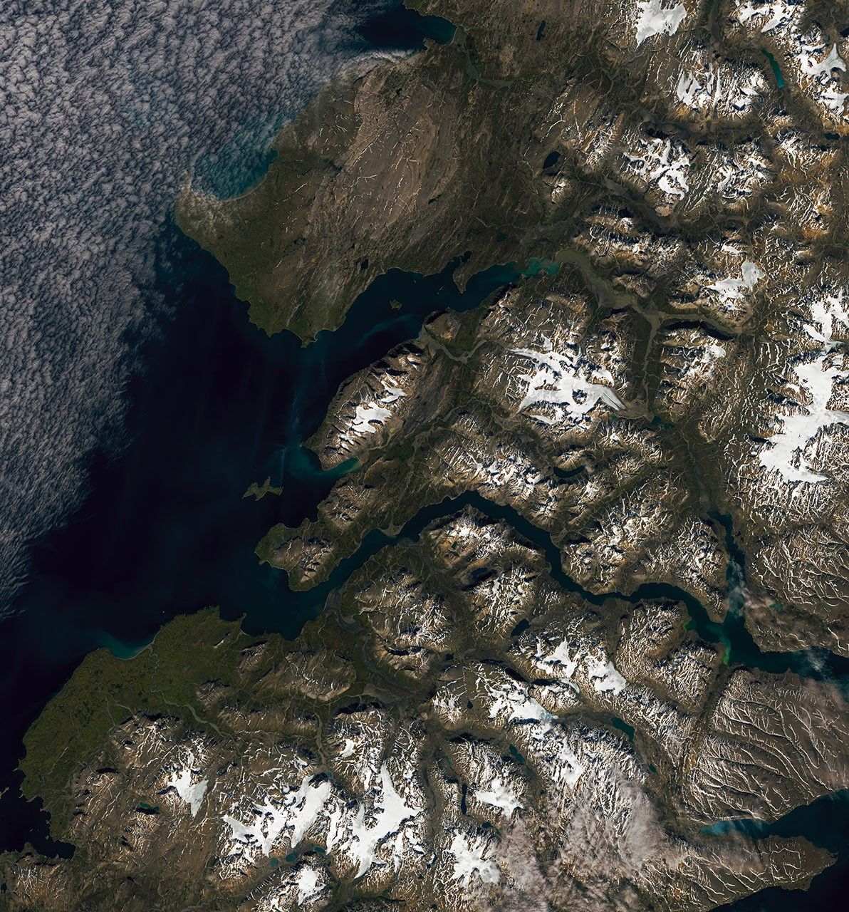
Call it an alluvial face-off. On the southern end of Severny Island in the Russian Arctic, rivers rush down from rugged terrain flanking a broad valley. Upon reaching flatter ground, the waters slow and distribute sediment into cone-shaped features called alluvial fans. Several appear in opposing orientations alongside a braided river in this Landsat 9 image.
Severny Island (Ostrov Severnyy) is a mountainous, uninhabited landmass in the frigid high latitudes of the Northern Hemisphere. Part of the Novaya Zemlya archipelago, the island is largely covered in glacial ice. Some glaciers, especially in the north, terminate in the sea, while others end on land, feeding meltwater into glacial streams.
Sediment-laden streams, along with the island’s topography, create favorable conditions for the formation of alluvial fans. The features typically appear at the base of steep mountain ranges, where narrow river channels open onto flatter terrain. There, rivers can slow, divide into smaller channels, and deposit sediment. Over time, the channels migrate back and forth to build up fan-shaped deposits. Dueling fans line several northwest-southeast-trending valleys in the wider view below.
Seasonal snowmelt and glacial runoff likely keep Severny’s rivers supplied with ample fan-building material. Hydrologists note that higher river flows during the warmer months, driven by snowmelt, can carry more sediment out of the mountains. Glaciers also produce large volumes of eroded material as they grind downslope, some of which flushes out in meltwater.
Smaller, land-terminating mountain glaciers, like those on southern Severny Island, are particularly prone to melting as the atmosphere warms. Severny’s ice is relatively understudied due to its remoteness, but satellite observations give scientists an understanding of its health. Recent analyses incorporating digital elevation models found that land-terminating glaciers across the Novaya Zemlya archipelago thinned during the 2000s and 2010s, especially at lower elevations.
NASA Earth Observatory images by Lauren Dauphin, using Landsat data from the U.S. Geological Survey. Story by Lindsey Doermann.
- Małecki, J. (2022) Recent contrasting behaviour of mountain glaciers across the European High Arctic revealed by ArcticDEM data. The Cryosphere, 16, 2067–2082.
- Melkonian, A.K., et al. (2016) Recent changes in glacier velocities and thinning at Novaya Zemlya. Remote Sensing of Environment, 174, 244-257.
- NASA Earth Observatory (2009, July 30) Novaya Zemlya. Accessed July 13, 2026.
- National Geographic Society (2023, October 19) Alluvial Fan. Accessed July 13, 2026.
- Science Education Resource Center, Carleton College (2026, June 9) Cold climate conditions as a driver of alluvial fan deposition in the Lost River Range, Idaho, USA. Accessed July 13, 2026.


